

In 2020 , all walks of life are tightening their belts, and tilted aerial photography projects are also facing the problem of cost reduction. Today, I will introduce a new platform for tilted aerial photography – autogyro, which can effectively reduce the cost of aerial photography and improve work efficiency.
1. Introduction to Autogyro Aircraft
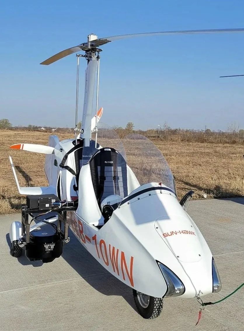
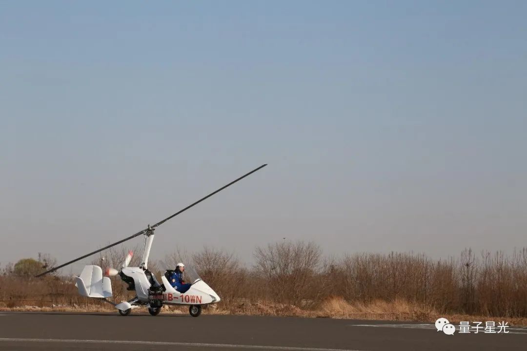
An autogyro is a rotorcraft that uses the relative airflow during forward flight to blow the rotor to rotate to generate lift. Its forward force is directly provided by the engine driving the propeller. It is an aircraft between a helicopter and an airplane. Since the rotor of the autogyro has no power, it does not have the large vibration and noise caused by the power-driven rotor system. It can be automatically adjusted so that the airframe has good pitch stability, roll stability and speed stability. The requirements for take-off and landing sites are also lower. Compared with the commonly used fixed-wing manned aircraft and rotor manned helicopters, autogyro aircraft has short take-off and landing distances, can fly at low speed and low altitude, has a simple structure and is easy to maintain, and has high safety. The cost and flight cost are low.
2. Equipment installation
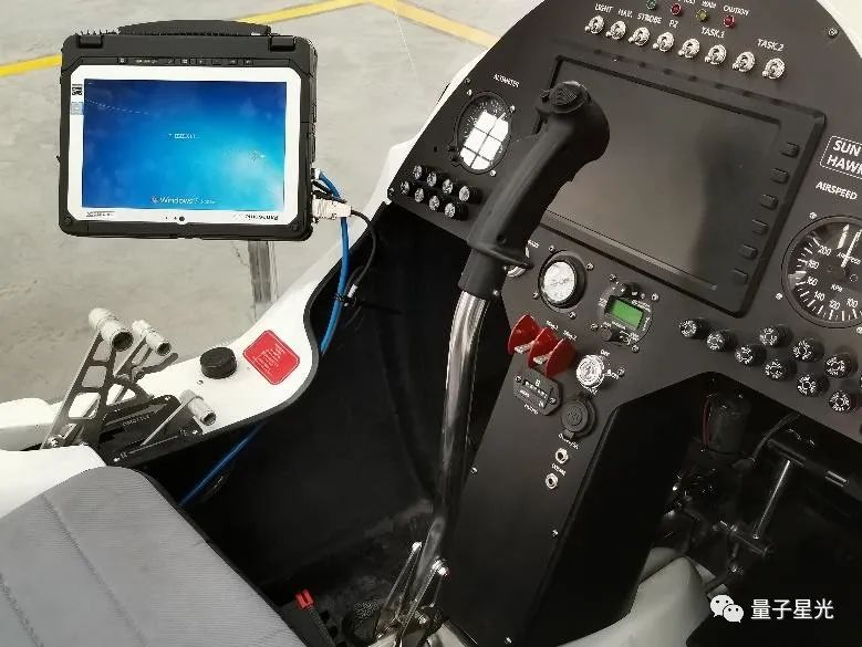
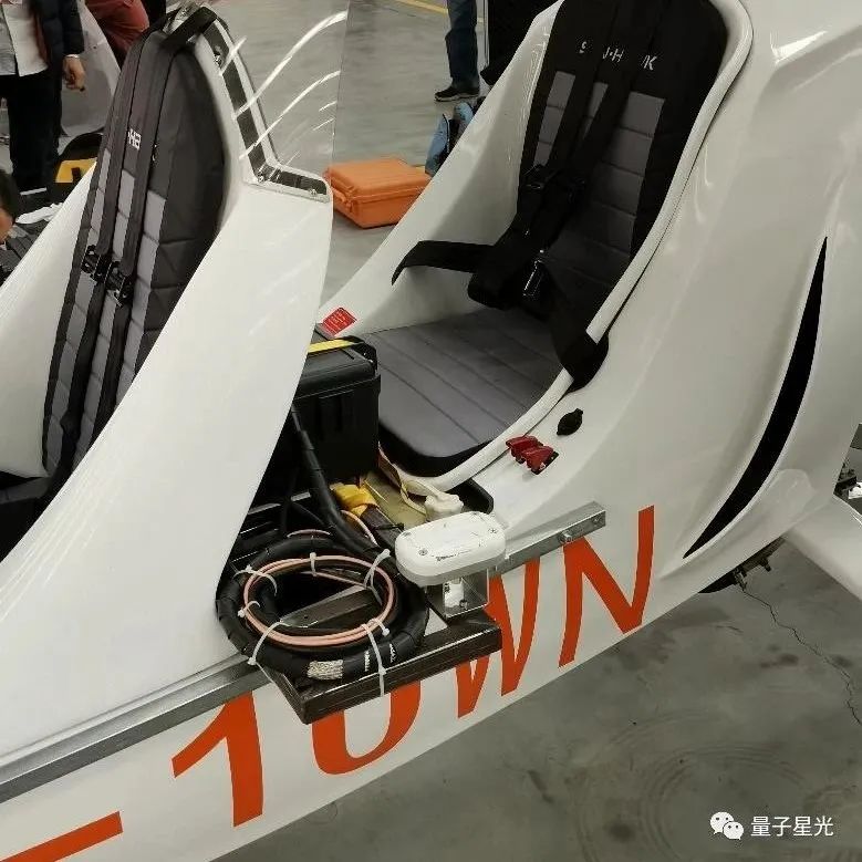
In order to verify the application effect of the autogyro aircraft in the tilt aerial photography project, our company installed the PAN-U5 tilt aerial photography instrument on the autogyro aircraft for several flight tests.
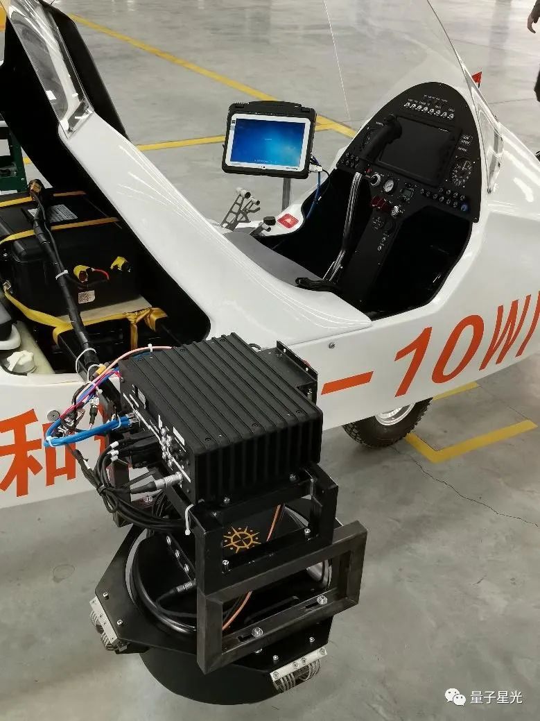
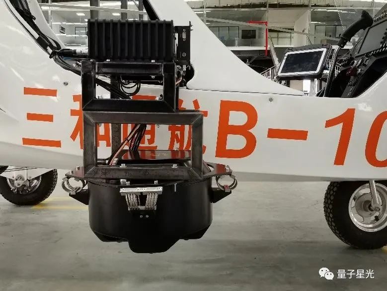
First of all, we designed the installation structure so that the PAN-U5 tilting aerial camera and supporting components can be successfully mounted on the selected autogyro without affecting the flight safety and the large-scale modification of the fuselage.
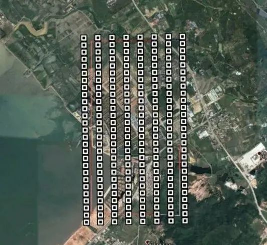
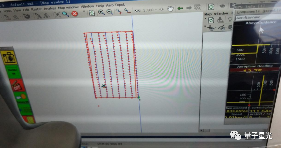
3. Route Planning
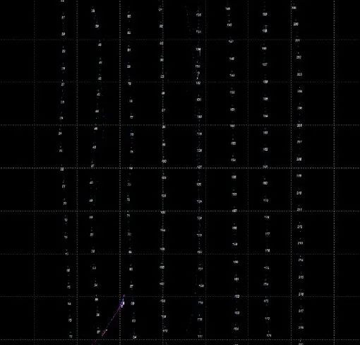
Route planning uses Aerotopol planning software to design according to course overlap of 80% , side overlap of 70% , and ground resolution of 4.5 cm. The planned route map is as follows:
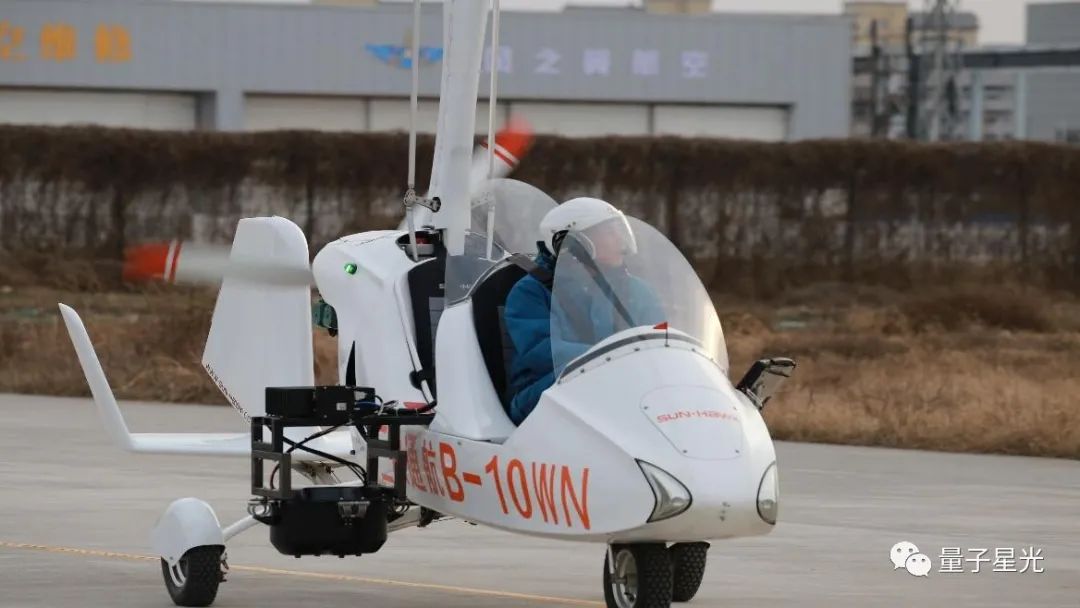
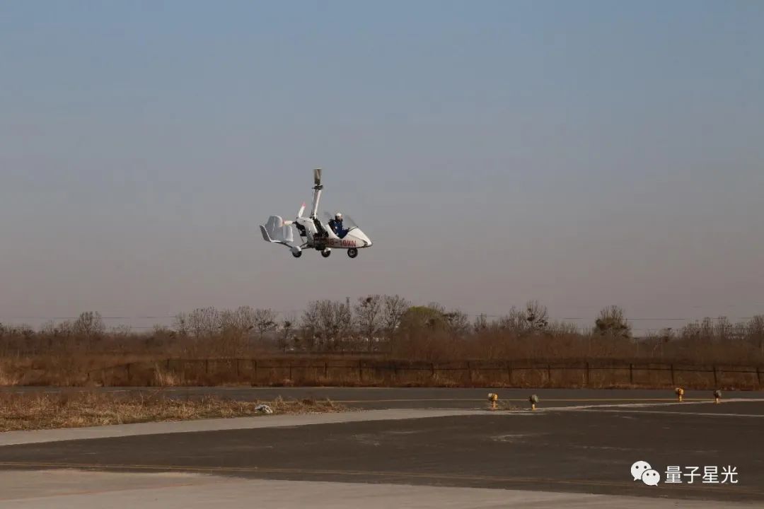
4. Flight
In order to improve the endurance time of the autogyro, we adopt the method of single-person inclined aerial photography flight. At the same time, the pilot performs the work of the aerial cameraman, mainly flying the route according to the navigation interface, and monitoring the normal operation of the equipment.
Aerial Oblique Aerial Photography
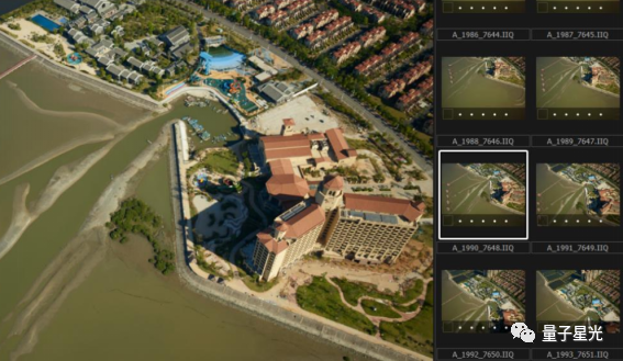
5. Image Data and POS Data
A total of 214*5 ( 1070 ) pieces of image data were acquired during this flight;
This POS calculation uses WaypointInertial Explorer 8.60 software, which is high-precision POS data obtained through high-precision ephemeris calculation .
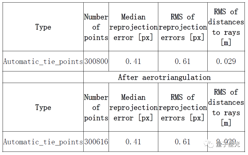
6. Air Three Report
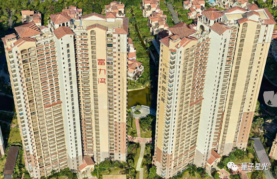
7. 3D Model
8. Conclusion
Through this test, it has been verified from various aspects such as equipment installation, data acquisition process and result quality that the combination scheme of autogyro aircraft equipped with PAN-U5 tilting aerial camera is feasible, with good stability and reliability.
Considering the cost of autogyro aircraft and operation and maintenance costs, compared with helicopters and fixed-wing aircraft, the cost of aerial photography can be greatly reduced.
Moreover, the flying speed of the autogyro can be reduced to 50km/h, and better quality images can be obtained in high-resolution tilting projects.

